Two tropical cyclones triggered torrential rainfall across Java, inundating the capital city of Jakarta and its surrounding areas for the fourth major time this year.
According to the Meteorology, Climatology and Geophysics Agency (BMKG), the series of floods that have inundated the capital region over the past two months are a result of climate change-driven global warming. Average temperatures in Indonesia peaked in 2019, with Jakarta experiencing an annual temperature rise 1.4 times higher than global trends. The agency recorded 278 millimeters of rainfall in 24 hours, categorizing the weather as ‘extreme rain’ with the city receiving one month’s worth of rain in a single day.
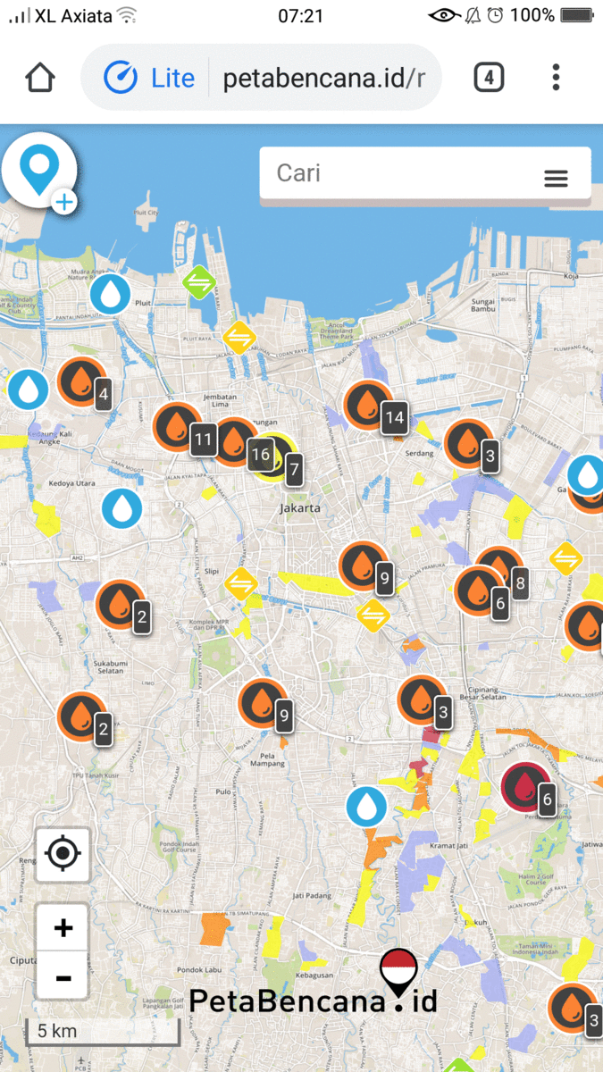
As flooding paralyzed traffic on major thoroughfares, disrupted commuter lines for over two consecutive days, inundated the state national hospital, and cut off electricity to over 1,600 substations, residents continued to search for verified information about the flood situation in order to make timely decisions about safety and response. Amidst a spread of misinformation, the National Emergency Management Agency (BNPB) endorsed PetaBencana.id as the official information sharing platform to collectively mitigate risk.
Thousands of residents contributed to crowd-sourced flood mapping by submitting flood reports to PetaBencana.id; informing each other about the severity of the flood, infrastructure failures, and response efforts. PetaBencana.id experienced a 26,000% increase in activity as residents actively checked the web-based map to understand the flooding situation, avoid flooded areas, and make decisions about safety and response. The Jakarta Emergency Management Agency (BPBD DKI Jakarta) monitored the map to respond to resident needs, coordinate response, and also updated the real-time map with information about flood affected neighborhoods.
On February 25th, MetroTV featured PetaBencana.id thrice on its breaking news segment, advising residents to check the open-source platform in order to stay up-to-date on the flooding situation and mitigate risk. Google Maps also sourced and linked to PetaBencana.id for verified flood information. As various news agencies shared the platform as a primary information source, thousands of residents used social media channels to share the real-time flood map, commenting on its ease of use, and commending its usefulness in navigating unanticipated disaster events.

As floodwaters disrupted the city, community-led information sharing continues to support response and planning efforts at multiple scales. Agus Wibowo, Head of the Center for Data, Information and Public Relations at the National Disaster Management Agency (BNPB), urged residents to share flood reports through PetaBencana.id, highlighting the significance of community led data collection, sharing, and visualization in reducing disaster risk and assisting field response.
Yayasan Peta Bencana thanks all residents of Indonesia for continuing to share critical information, and applauds the indispensable role of all residents in helping neighbors, government agencies, responders, and researchers develop strategies for climate adaptation.
As BMKG predicts extreme rainfall to continue until March, Dwikorita Karnawati, Head of BMKG, emphasizes the need for improved coordination and synergy between multiple stakeholders for climate adaptation efforts.
Residents of Indonesia can submit real-time flood reports by tweeting #banjir @petabencana, sending a Facebook message to @petabencana.id, or sending a Telegram message to @bencanabot. We remind everyone to check https://petabencana.id for up-to-date information and to stay safe!
PetaBencana.id is a part of the USAID BNPB InAWARE: Disaster Management Early Warning and Decision Support Capacity Enhancement Project in Indonesia. PetaBencana.id is supported by the U.S. Agency for International Development (USAID). The project is made possible through collaboration with project partners including the Pacific Disaster Center at the University of Hawaii and the Humanitarian OpenStreetMap Team; our implementing partners at the National Emergency Management Agency (BNPB) and Jakarta Emergency Management Agency (BPBD DKI Jakarta); and, our data partners including Mapbox, Twitter, Qlue, and PasangMata.