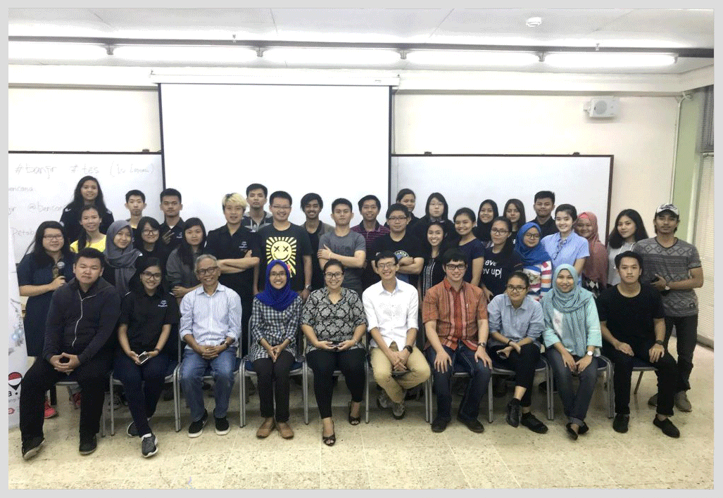
MIT adapts CogniCity OSS to support risk planning for Hurricane Irma

quote open    This type of information will assist us with assessing damage in real time during the storm event and help prioritize response efforts after the storm.        quote close

The MIT Urban Risk Lab is successfully employing the software developed for PetaBencana.id to support risk planning for Hurricane Irma. Through gathering crowdsourced confirmed situational reports via social media, the platform, RiskMap.us, tracks flooding during Hurricane Irma in real time.

The publicly available map, currently being piloted in Broward County, Florida, allows residents , government officials, and first responders to stay informed about changing flood conditions across the county, in order to prepare for and respond to emergency events. At a news conference on Friday, Broward County Mayor Barabara Sharief said that the map will help assess the damage in real-time and help prioritize response efforts.

We’re excited to see CogniCity Open Source Software continue to support geographies outside Indonesia, and in the spirit of open-source, the ways by which partnering teams have been able to build and expand upon existing bodies of work! Read More

CogniCity OSS Adapted to power a Flood Mapping Platform in Vietnam

Members from the team at SmartSaigon, an open source flood mapping platform in Vietnam, came to visit PetaBencana.id to exchange ideas on the use and implementation of crowdsourced data for disaster risk management. The team has adapted the same software powering PetaBencana.id, CogniCity Open Source Software, to develop and support a flood mapping platform for Saigon. It was great to see how CogniCity has been able to serve as a framework supporting geographies outside Indonesia, and how the team at SmartSaigon have used the software to build and expand upon existing bodies of work. 

The SmartSaigon team also met with the Jakarta Disaster Management Agency, Jakarta Smart City, and Pulse Lab Jakarta, to learn about PetaBencana.id’s collaborations with various stakeholders in Jakarta. While SmartSaigon and PetaBencana serve very distinct contexts, we were able to share lessons learnt from both similar, and dissimilar, experiences. PetaBencana was very excited to learn about the ways that SmartSaigon has developed strategies to support the unique urban practices in Saigon, including the incorporation and integration of chatbots on different social media platforms pertinent to the city. It was great to also learn about the ways in which CogniCity has been modified to attune to the unique perceptions of risk in Saigon. Read More

2017 Asia GeoSpatial Excellence Award

quote open .     Our Jury believes that National Disaster Management Authority’s project PetaBencana.id demonstrates the power of geospatial information and technology in impacting the lives of people at grassroots level and strengthening disaster preparedness, thereby highlighting its role as a tool in socio-economic development.          quote close

The National Disaster Management Agency of Indonesia (BNPB) received the 2017 Asia GeoSpatial Excellence Award for their implementation of PetaBencana.id. The award recognizes the application of geospatial technologies to strengthen resident engagement.

Jakarta Governor Endorses PetaBencana.id

2017_JakartaGovernorTweetviaInstagramandMetroTV.jpg

quote open .     Jakarta citizens, be cautious of flooded areas…Check the locations of flooded areas on PetaBencana.id…Here are some screenshots of yesterday’s flood, in the morning, afternoon, and evening.          quote close

The governor of Jakarta, Basuki Tjahaja Purnama, posted annotated screen captures of Petabencana.id to his Instagram account during the 2017 monsoon season, calling for residents to check the map in order to stay informed. In a story about the Governor’s social media usage, MetroTV News described how emergency management agencies were able to respond to the flooding situation immediately because of the platform.

Read the full article here

OECD features PetaBencana.id as a Case Study

2017_OECD_Casestudy.jpg

quote open .   …since 2015, BNPB has used the platform as part of its daily emergency management operations, representing a breakthrough in information exchange with citizens.        quote close

PetaBencana.id is featured as a case study in OECD’s report on innovative governance practices. The report commends the unintrusive integration of the platform into the National Disaster Management Agency’s existing disaster risk management information ecosystem, representing a major advance on the agency’s previous information dissemination systems.

Read the full report here

ODI Showcase Award

2016_ODI_ShowcaseAward.jpg

quote open .     The map – and the software and data behind it – are shared openly, so can be integrated into systems from government agencies and NGOs tasked with responding to the flooding. This offers a practical solution for developing platforms of civic co-management in cities facing extreme weather events.          quote close

The pilot project, PetaJakarta.org, was the recipient of the 2016 ODI Showcase Award. The award supports projects that demonstrate how open data can be used to benefit individuals, organisations, and society.

Read the full article here

FCC Recommends the Project as a Model for Disaster Information Crowdsourcing

2016_TheFederalCommunicationsCommission_ExampleOfBestPractice.jpg

quote open .     To what extent would it be possible to leverage this model as a best practice for automated crowdsourcing of reliable emergency response data, using regulated alerting platforms in the United States?          quote close

In 2016, the Federal Communication Commission of the United States recommended the pilot project, PetaJakarta.org, as the best model for a new disaster information crowdsourcing platform.

Read the full document here

The Guardian Media Feature

2016_TheGuardian.jpg

quote open .     Perhaps the most significant success of the system was its use by the Jakarta emergency management agency (BPBD DKI Jakarta). In 2015 the agency used PetaJakarta.org as an early warning system, allowing it to identify and cross-verify locations of flooding, speed up its response, and communicate with residents in flood-affected areas in real-time.      quote close

In a Guardian op-ed for the Public Leaders Network, the project co-directors highlighted the success of PetaJakarta.org in enabling the Jakarta Emergency Management Agency to increase response times and share critical information with residents during flood events.  

Read the full article here

IFRC recommends the project as model for disaster response

2015_IFRC_ExampleofBestPractice.jpg

quote open .     …a tool that responds to the way disasters actually unfold and the way people really react, rather than predicted or idealized projections of behaviour.          quote close

The 2015 World Disasters Report recognizes the role that local actors play in emergency situations. The pilot project, PetaJakarta.org, was recommended as a model for empowering local actors and changing the nature of community-level disaster response.

Read the full report here

Parliament of Australia Commends Project as Example of Best Practice

2015_ParliamentofAustraliaStandingCommitteeofInfrastructureandCommunications.jpg

quote open .     … when we talk about not just Australia but disaster management, knowing when and where the flood is going to reach and aligning that with the information that you could provide through Twitter and layer the two together, then the capability of managing disasters of a great variation would be very useful. That is why the issue around this type of technology, working across a number of fields, could be really useful.          quote close

In a deposition to the Standing Committee on Infrastructure and Communications of the Government of Australia, project co-director Dr. Tomas Holderness recommended PetaJakarta.org as model for transforming social media into actionable information for residents and decision makers. The project was commended for its ability to work and integrate data openly across multiple fields.

Read the full deposition here

National Geographic Media Feature

2014_NationalGeographic

quote open .   PetaJakarta.org enables the residents of Jakarta to easily understand the locations of flooded areas…        quote close

In an article titled “Now Jakarta Residents Can Know the Locations of Flooded Areas,” National Geographic Indonesia described how the platform has increased situational knowledge among residents and has become a tool for critical information sharing and dissemination in Jakarta.

Read the full article here

Twitter #DataGrant

2013_TwitterDataGrant

quote open .  By leveraging Twitter’s real time information network, PetaJakarta.org uses social data to help improve the lives of millions of people.     quote close

In 2013, PetaJakarta.org was selected as one of six recipients of the first Twitter Data Grant. The competitive program was launched by Twitter to connect researchers with Twitter data for real-world applications. The Twitter Data Grant map visualizes flood-related Tweets across Jakarta between November 2013 and February 2014.

Read the full story here